TREKKING INFORMATION ABOUT COLCA CANYON - INDEPENDENTLY
Author: Ludwig Betalleluz Uribe, Owner of Pachamama hostel in Cabanaconde - Colca Canyon,
 I am, Ludwig Betalleluz, a professional trekking guide in Arequipa region since 2002. I like to share my experience gained as a guide in order to encourage the development of a different sort of Tourism in Colca Canyon - Cabanaconde.
Nowadays I do not work as a guide, but I am the owner of a family hostel in Cabanaconde which it is called Pachamama and where my family works. I also do PHOTOGRAPHY as part of my favorite hobbies and you can appreciate my pictures in my hostel.
The only purpose of this article is just to give a complete information of Trekking in the Colca Canyon
. After reading this article you will know the possibilities of trekking in Colca Canyon. This article will also promote local tourism in the villages of Cabanaconde, San Juan de Chuccho, Tapay, Llahuar ( not a village), Llatica, and Fure which they all can be visited by just doing trekking. I invite you to visit Cabanaconde and explore Colca Canyon in a different and responsible way.
Finally, I make clear that this article is only to give you comprehensive information and valuable recommendations about traditional and alternative trekking routes in Colca Canyon, so please read carefully the recommendations before hiking in Colca Canyon. You can visit Pachamama Hostel where you find plenty of information, join other hikers and you can also get a good trekking map.
You can also join some TOURS TO COLCA that are exclusively organized by Pachamamahome.
If you have questions or you would like to cooperate with updating any information I will be grateful.
COLCA CANYON
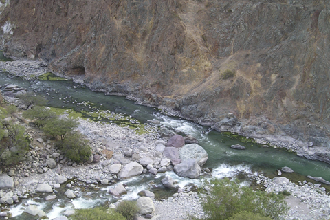
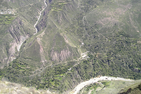
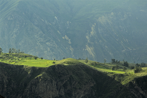
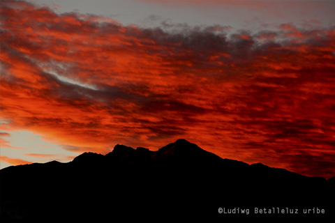
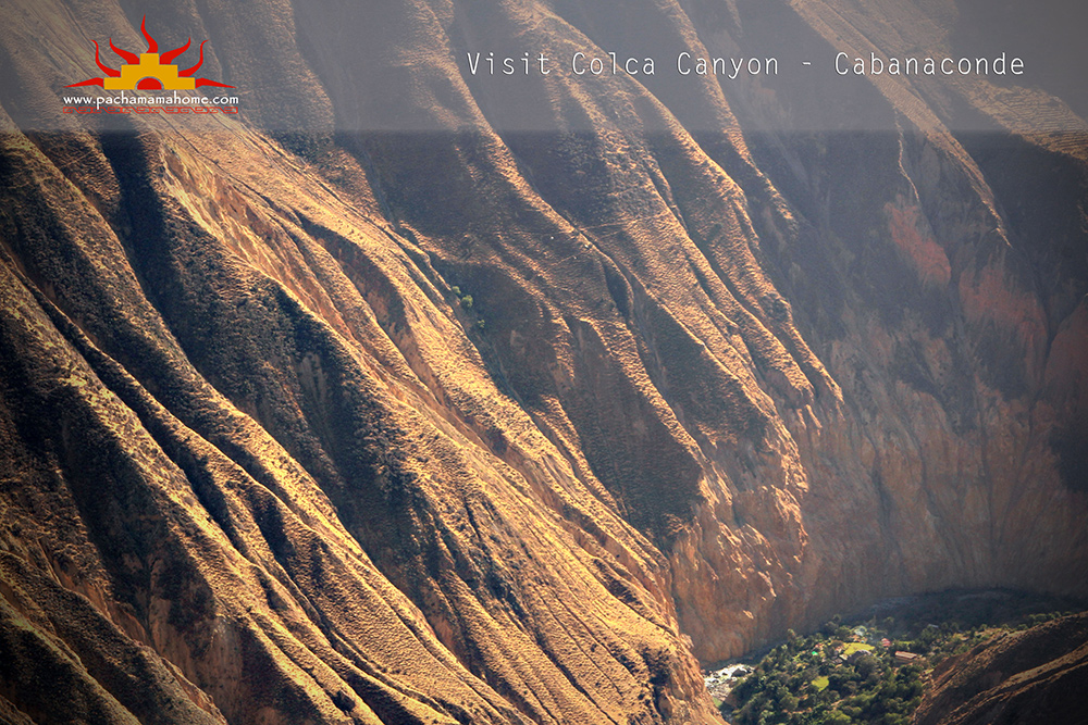
Colca Canyon is located in the department of Arequipa, this is the most important attraction of the province and considered one of the deepest canyons in the world (4,160 meters), twice as deep than the Grand Canyon (USA). Colca Canyon is amazingly appreciated from the villages of Pinchollo, Cabanaconde, Tapay and Huambo.
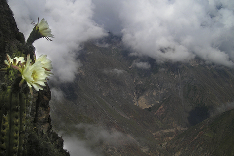
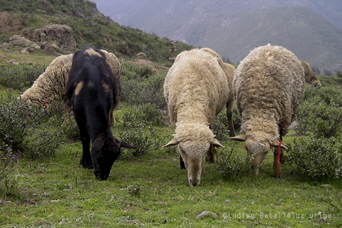
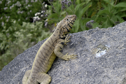
Flora and Fauna in Colca Canyon are rich and you can definitely appreciate by visiting Colca Canyon. The Andean Condor is the main icon of the fauna, it can be seen at Cruz del Condor. The list of Flora and Fauna is big, we won't describe here since we are just focused in trekking information.
The cultural richness of Colca Canyon is enormous and is embedded in the 14 villages that are found throughout the Colca Valley. The Collaguas and Cabanas are people of different ethnic groups that lives in Colca Canyon, their most outstanding legacy is the construction of thousands of terraces.
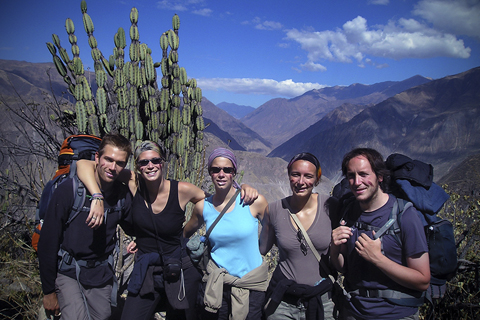
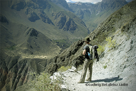
Trekking is the best way to explore the depth of Colca Canyon. The beginning for all trails in Colca Canyon start from Cabanaconde. It is not for everyone, but for those who loves trekking it is a great experience. You can also visit and enjoy from great views by visiting the village of Cabanaconde.
CABANACONDE (3,300mts)
Most of the trekking in Colca Canyon starts in Cabanaconde village. 5 1/2 hrs. From Arequipa by bus and only 20 minutes to Mirador Cruz del Condor. Visiting Cabanaconde is being in one of the most traditional places in Colca Canyon. More information about Cabanaconde here.
INDEPENDENTLY TREKKING IN COLCA CANYON
Can We trek independently in Colca Canyon?.
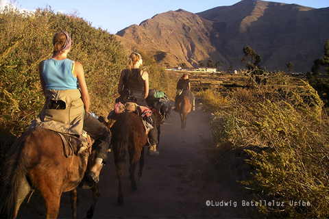
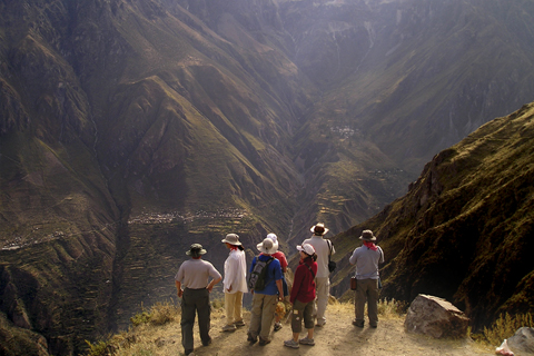
Yes, you can!. Trekking in Colca Canyon is not difficult as most travel agencies always say. Trails are obvious in the most common trekking routes as San Juan de Chuccho and Sangalle (classic trekking tour). You can see most of the trails from the viewpoints and I always recommend hikers to recognize these lookouts before start trekking. This is why is important to come to Cabanaconde because you can explore first the area, acclimatize and plan your trekking.
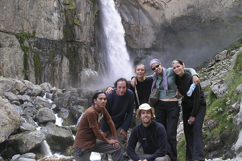
I must say that the trekking to Llahuar and Fure is less visited so you need more information, but at Pachamama hostel there are always people, most of them are couples or group of friends who come and wants to do trekking on their own, if you are an alone traveler Pachamama is the right place to meet other hikers. At Pachamama you will definitely get good tips for trekking in Colca Canyon
If you decide to arrange an organized tour from Arequipa it is important you make sure the local people get a real benefit, by paying a cheap trekking tour then you are not helping, locals are being exploited and as well their trekking guides. As I said local people get more benefit if you come straight to Cabanaconde, but It is easy to find out this.
By visiting independently the town of Cabanaconde it is a different way of travelling and exploring Colca Canyon. It may not be for everyone, but you can also buy a tour from Arequipa or hire our trekking services with a local guide. Pachamama is not the only place to stay in Cabanaconde, you also find some hotels and restaurants. Besides all of it you get a real touch of what a Peruvian Village is...
Advantages of Travelling Independently
- ▸ You have more freedom in your itinerary.
- ▸ You are more in contact with local people and nature.
- ▸ Local people benefit economically.
- ▸ You can decide what trek to do.
- ▸ The experience is different and personal.
- ▸ You can explore Viewpoints as long as you want.
- ▸ You have more chances to observe Condors. Etc...
Please don’t hike in the canyon without obtaining information beforehand!
TRAVEL AGENCIES AND INDEPENDENT HIKING IN COLCA CANYON
Travel agencies always try to misdirect tourist who wants to visit Cabanaconde - Colca Canyon. They say it is dangerous to hike without a guide, do not go on your own to Colca Canyon, etc. They sell tours and by buying their tours is fine, but saying that coming to Cabanaconde on your own is dangerous that is not quite honest. You can hire a tour for many reason and we are not against that, their services are very good and their guides are very nice people and professional (if you buy in the right travel agency). You choose what it is better for you, by buying a tour for most people would be better and helpful in matters of organization and by coming on your own it is just visiting a different way.
There have been reports of accidents in Colca Canyon, like in most places in the world these cases are not the exceptions. An accident occurs randomly and it is most to people who does not take the necessary precautions and recommendations. Examples of reports are: someone drowned drunk in the pool, a Spanish died because his bottle of water felt in a very dangerous cliff and he tried to reach it, some tourists got lost by walking at dark, a Brazilian girl felt from a mule and that happen with a travel agency, etc. Accidents can happen any time you just need to be cautious and it is important to get all information possible.
We recommend you to make a plan of your trek beforehand and get all information you need. Do not hike alone, in Pachamama you can definitely join other travelers, paths are fine, not dangerous animals, not robbery in the Canyon. We have very good information and we just want to focus by promoting local tourism even if people say that is not.
In worst-case you can also hire our tours services or hire a local guide from Cabanaconde. More information

NEW!
NEW TREKKING MAP OF COLCA CANYON 2017

You can buy our new trekking map at Pachamama hostel. This trekking map of Colca Canyon is the most updated that you can find in Arequipa. I made this Map in order to help other hikers to get oriented and get extra informaction and let them know the possibilities of trekking in the area. You can only buy this map at Pachamama.
Our new trekking map of Colca Canyon 2017 contents valuable information:
▸ A well done and update map and easy to understand it.
▸ Options and possibilities of trekking 1, 2, 3, 4 days inside Colca Canyon.
▸ Information about the starts for each trek.
▸ Altitude of the villages.
▸ Level differences.
▸ Distances in km. and timings from village to village, etc.
If you have any questions, please feel free to contact us to this Email Address: colcapachamama@gmail.com
TRAILS, WATER AND FOOD IN COLCA CANYON
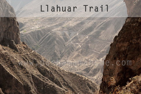
THE TRAILS IN COLCA CANYON
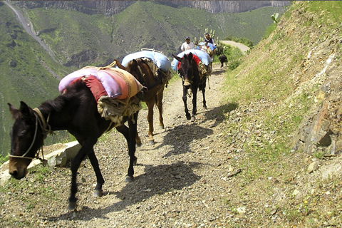
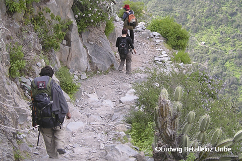
There are certainly not any signaling systems for trails in Colca Canyon. The biggest reason is that Autocolca (Organization in charge of promoting tourism) does not so much for it. But that it does not mean trails are dangerous and not easy to find. Local people have been using them for hundreds of years and they are responsible of repairing them if something happens to their trails. These paths are quite notorious to recognize you can also have an idea that people walk with their mules, so we understand they are big enough. You will always find simple signs when you are close to family houses.
Our Recommendation is to follow always a good path and you must know the start for the trekking. See here the starts for your trekking colca canyon.
FOOD IN COLCA CANYON
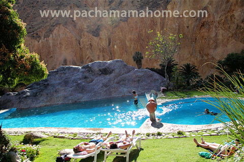
Food is very basic, but good. In most family houses and bungalows in Sangalle (Oasis) you will always find set menus; their prices vary between 10.00 to 15.00 soles. They will also offer you vegetarian food. Every family house or bungalow has their little shop where you can buy water, beer and snacks.
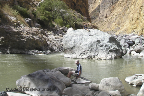
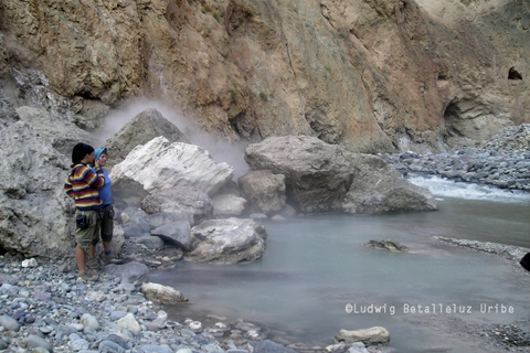
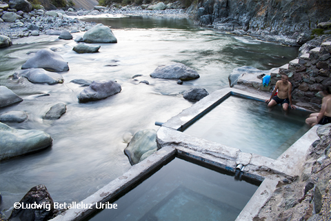
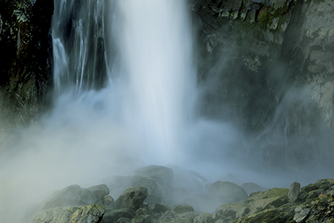
WATER SOURCES IN COLCA CANYON
You can easily find some good water resources in Colca Canyon, but we definitely recommend you to purify the water from any source, bring your own tablets from your country or buy it in Arequipa. Most of the family houses have good fresh water and you can fill your bottles there and use them after been purified. You can also buy in their little shops mineral water, price can be 3 times more expensive, but it is understandable the big effort they spend in bringing water from Cabanaconde. A very good advice is to refuel your water in little villages and not carry so much since you can find in every village a shop. We also recommend you to bring all your plastic bottles back to Cabanaconde, locals burns the plastic and it is not good for the environment. You can drop your plastic bottles at Pachamama.
HOSTEL, FAMILY HOMESTAY, BUNGALOWS IN COLCA CANYON
It is easy to find a place to sleep during the trekking in Colca Canyon, but in high season (May- Sept) we recommend you to book in advance. It is not necessary to bring a tent, unless you love camping. The family homestays in Colca Canyon offers a basic accommodation, share toilets and showers for a cheap price. It is impossible that you will find a fancy place, which it is fine and it is part of experience when you trek. Modernizations is not found in Colca Canyon trek, so do not expect it. We can help you to book a family homestay in Colca Canyon.

A LIST OF WHAT YOU NEED FOR THE HIKE IN COLCA CANYON
- ▸ Energy...Positive...Happiness...Love Nature....Respect Nature...✓
- ▸ BRING CASH, no atm or bank in the village of Cabanaconde. ✓ Important!
- ▸ A good Trekking shoes. ✓
- ▸ Cellphone (You will find some signal in some villages).✓
- ▸ Trekking Map (You can get one at Pachamama).✓
- ▸ A day backpack.✓
- ▸ A Cap.✓
- ▸ Sun Block with SPF of at least 50.✓
- ▸ Sun Glasses.✓
- ▸ At night gets a bit cold, so you need a jacket or a good fleece sweater.✓
- ▸ Convertible Pant are ideal for the hike.✓
- ▸ Bathing suit.✓
- ▸ Flash-light and extra batteries.✓
- ▸ Watch.✓
- ▸ Purification Tablets (optional)✓
- ▸ A lighter or matches.✓
- ▸ whistle.✓
- ▸ Basic First aid-kit.✓
- ▸ Snacks.✓
RECOMMENDATIONS DURING YOUR TREKKING INTO COLCA CANYON
Always take precautions to prevent misadventures during your hike. It is true that there have been incidents in Colca Canyon, but it is due to the lack of information and recklessness of yourself. There are good resources for information and Pachamama We will inform you all about it. Some treks you need a guide, so we can help you to arrange this service. A local guide will guide you well. Get a Local trekking guide Here.
- ▸ Depart early for your trek, let's say 7am it is a good time and do not hike after 2pm.✓
- ▸ Get early to your destination or before dark. Do not expose yourself in danger by walking at dark or taking short-cuts.✓
- ▸ Take with you your cell-phone, there is signal in most villages and some parts of the trek.✓
- ▸ Walk through save paths, avoid short-cuts. Trails are very obvious.✓
- ▸ Fill your water in every village.✓
- ▸ Ask to locals if you are in the good trail, you can meet locals working in their farms.✓
- ▸ Do not hike if you are sick or Vertigo.✓
- ▸ Do not forget to take your cell-phone with you.✓
- ▸ Carry enough things for your hike. A day bagpack is enough; keep in my mind that walking in Colca Canyon you can climb from 700mts to 1,200mts level difference. You do not need sleeping bag.✓
- ▸ Let know your hostel what trek your departing for, how many days, when you come back, etc.✓
- ▸ Carry your tourist ticket; there is control in viewpoint and bridges, so there is not way to avoid paying.✓
- ▸ Do not hike alone, meet other travellers. Pachamama Hostel is the perfect place to meet other hikers.✓
- ▸ Get all the information for your planned hike.✓
- ▸ When you hire a mule, make sure the horse tack are in good conditions.✓
- ▸ Never get close to dangerous cliffs.✓
- ▸ Do not touch unknown plants such as qatupa.✓
- ▸ Do not fire.✓


